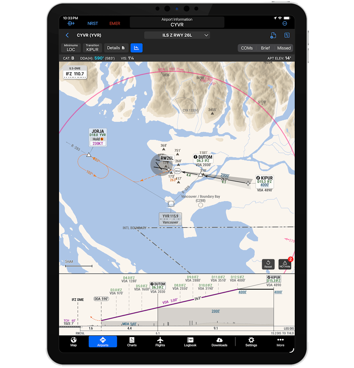
With SmartCharts coverage extended to airports in Canada and Mexico, the Garmin Pilot™ app is set to streamline your instrument flying in even more regions. In addition to the charting features already offered for the U.S. and the Bahamas, the Canadian versions also get continuous descent final approach paths shown on the vertical profile view. The charts will also offer added support for operations on cold-temperature-restricted airports in Canada and the U.S.
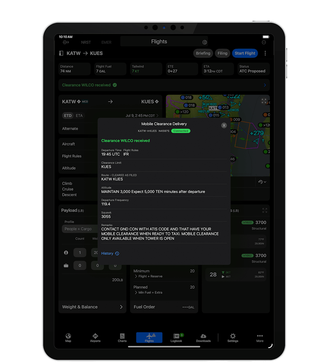
After a successful launch at Oshkosh, Mobile Clearance Delivery1 is continuing to expand across select U.S. airports, with the recent additions of Wheeler Downtown (KMKC), Johnson County Executive (KOJC) and Easterwood Field (KCLL), alongside New Century AirCenter (KIXD), Hooks Field (KDWH), Sugar Land (KSGR), Galveston (KGLS) and Appleton (KATW). This new Garmin Pilot feature allows you to seamlessly plan, file and pick up your text-based ATC clearances on Apple® mobile devices — and then have the data pushed directly to compatible Garmin avionics in your cockpit.
Join a series of webinars and classes by Garmin aviation professionals offering tips and insights on the latest generation of Garmin avionics, portable navigation solutions, services and more. Check out the upcoming topics: